-

by
Joe Lombardi
Weather
Damaging wind gusts of 50 miles per hour will be the main threat in this region for a potent pre-Christmas storm accompanied by a cold front that will sweep through the Northeast and result in a dramatic drop in temperatures.The time frame for the storm is a period of approximately 24 hours from Thursday, Dec. 22 to Friday, Dec. 23.Heavy downpours could also lead to poor travel ...
-
by
Joe Lombardi
Weather
Damaging wind gusts of 50 miles per hour will be the main threat in this region for a potent pre-Christmas storm accompanied by a cold front that will sweep through the Northeast and result in a dramatic drop in temperatures.The time frame for the storm is a period of approximately 24 hours from Thursday, Dec. 22 to Friday, Dec. 23.Heavy downpours could also lead to poor travel ...
-

by
Joe Lombardi
Weather
A cold front that accompanied a potent storm system that caused power outages throughout the region has ushered in cold temperatures and will be followed by another round of gusty storms.A breezy and chilly day is in store to start the first day of December as strong high pressure begins to build in from the west, according to the National Weather Service.Wind-chill value temperatures ...
-
by
Joe Lombardi
Weather
A cold front that accompanied a potent storm system that caused power outages throughout the region has ushered in cold temperatures and will be followed by another round of gusty storms.A breezy and chilly day is in store to start the first day of December as strong high pressure begins to build in from the west, according to the National Weather Service.Wind-chill value temperatures ...
-

by
Joe Lombardi
Weather
A springlike stretch of weather will finally come to an end as a cold front moves through the region followed by potential impacts from a storm system developing in the Atlantic.The cold front is gradually approaching on Sunday, Nov. 6, and will move through on Monday, Nov. 7, according to the National Weather Service.Before the front pushes through, high temperatures will rise into the ...
-

by
Joe Lombardi
Weather
A burst of cold air that will engulf the Northeast early this week will make it feel more like mid-November than mid-October, with wintry precipitation possible in some areas.Sunday, Oct. 16 will be partly cloudy and cooler with a high temperature in the upper 50s, providing perfect conditions to go apple-picking or enjoy the fall foliage.The arrival of a cold front on Monday, Oct. 17 ...
-

by
Joe Lombardi
Weather
A burst of cold air that will engulf the Northeast will make it feel more like mid-November than mid-October, with wintry precipitation possible in some areas.The arrival of a cold front on Monday, Oct. 17 will bring some showers or thunderstorms at times on a mostly cloudy day with a high temperature in the mid-50s, according to the National Weather Service.Overnight Monday into ...
-

by
Joe Lombardi
Weather
Scattered showers and potentially potent thunderstorms are expected ahead of an approaching cold front Sunday, Sept. 25 into the overnight hours of Monday morning, Sept. 26,.A few of the storms could become strong to severe, according to the National Weather Service, which noted that the primary threat from the system will be damaging winds.Gusts could be as high as 55 to 60 miles per ...
-

by
Joe Lombardi
Weather
The arrival of a cold front will lead to a new round of showers and thunderstorms, followed by a big change in the weather pattern just as fall starts.It will be warm and dry through much of the day on Wednesday, Sept. 21, according to National Weather Service. The high temperature will be around 80 degrees.There could be scattered thunderstorms in some spots Wednesday evening in ...
-
by
Michael Mashburn
Weather
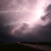
Severe weather could be an issue around the region Thursday, July 28.The National Weather Service in Albany issued a severe thunderstorm watch that included much of the region, including Albany, Schenectady, Rensselaer, Dutchess, Ulster, and Sullivan counties.Forecasters said an approaching cold front will bring showers and thunderstorms to the region, mainly after 4 p.m. Some storms ...
-

by
Joe Lombardi
Weather
A slow-moving cold front will trigger a new round of thunderstorms, some of which could be severe, that will bring much-needed relief from one of the most prolonged heat waves the region has seen in years.The current projected time frame for the new storm system on Monday, July 25 is from the mid-afternoon to the mid-evening. (See the first image above. The main threat from the storms ...
-
by
Joe Lombardi
Weather
A new round of steamy thunderstorms will bring much-needed relief from one of the most prolonged heat waves the region has seen in years, but not before sweltering conditions last through the weekend.The current projected time frame for the new storm system on Monday, July 25 is from the mid-afternoon to the mid-evening. (See the first image above.)"There is a threat for isolated to ...


